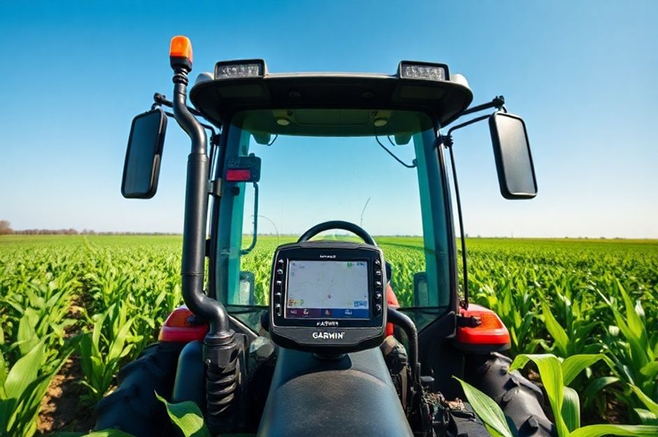
For years, farmers have sought ways to optimize crop yields. The integration of GPS technology, particularly Garmin GPS, has revolutionized farming practices. Utilizing GPS mapping in conjunction with tractors and planters enables farmers to maximize land usage through precision decision-making. Consider a ten-acre square plot of land. Traditional planting methods, reliant on visual estimation and manual alignment, often resulted in minor deviations that compounded over time, leading to significant losses.
These seemingly insignificant errors, akin to the butterfly effect, could result in entire crop rows being abandoned. GPS technology mitigates this risk by enabling accurate land mapping and precise row placement, potentially fitting an extra row of crops like corn within the same area. By creating accurate maps using Garmin GPS, farmers can ensure optimal crop growth and alignment.
Furthermore, GPS enhances operational efficiency. Farm vehicles, equipped with GPS, can maintain straight lines during seeding, ensuring consistent planting depth and spacing. Even handheld Garmin GPS devices can be used to guide seeding operations, providing real-time feedback on alignment. This marginal increase in production translates to increased profit, a crucial factor in maintaining profitability in challenging economic times.
Even smaller farms can benefit significantly. By mapping land and utilizing previously wasted space, farmers can leverage Garmin GPS to increase food production. Previously unusable areas can be repurposed for smaller crops like tomatoes or pumpkins, generating additional revenue. These seemingly small gains accumulate, exemplifying the positive side of the butterfly effect. Saving an inch per row translates to a foot every twelve rows, and three feet after thirty-six rows – an improvement unattainable without GPS technology. GPS empowers farmers to maximize their land’s potential, ensuring greater efficiency and profitability.